Cyclone Alfred 2025: A Comprehensive Update
Cyclone Alfred, which formed in the early days of 2025, has captured the attention of meteorologists, government agencies, and residents along Australia’s eastern coastline. This report provides an in-depth analysis of Cyclone Alfred, detailing its development, impacts, predictions, and safety measures. With the cyclone currently evolving, it is crucial to understand the various elements affecting the Queensland coast and beyond, as well as staying informed with real-time updates. Below is a step-by-step breakdown of Cyclone Alfred’s progression, its potential impact, and the measures being taken to ensure public safety.
1. Formation and Development of Cyclone Alfred
Cyclone Alfred started as a tropical disturbance off the coast of Queensland in the Coral Sea around February 22, 2025. Over the following days, the system gathered strength due to favorable atmospheric conditions, including warm sea surface temperatures and low wind shear. By February 25, the disturbance had evolved into a Tropical Depression, with sustained winds of about 65 km/h, before rapidly intensifying into a Category 1 cyclone.
By February 27, Cyclone Alfred had strengthened to Category 3 intensity with wind speeds reaching up to 150 km/h and gusts of 200 km/h. This marked the beginning of Alfred’s most dangerous phase, with heavy rains, strong winds, and high waves expected to impact coastal areas. The system was initially expected to track toward the northern Queensland coast, though later forecasts indicated that its trajectory could change, potentially affecting central and southern parts of the state.
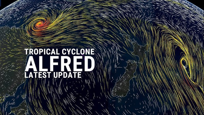
2. Current Status and Position
As of March 1, 2025, Cyclone Alfred is categorized as a Category 3 tropical cyclone, with maximum sustained winds of 150 km/h near its center and gusts reaching 200 km/h. The storm is located approximately 600 km east-northeast of Rockhampton, continuing to move southwestward toward the coast of Queensland. The central pressure of the cyclone is recorded at 960 hPa. It has been slowly weakening as it moves further southward, but it remains a formidable system.
Cyclone Alfred’s projected path is still uncertain. Some models predict the cyclone will weaken and turn eastward, staying offshore, while others suggest a more inland route. Regardless of the exact trajectory, authorities continue to monitor its movement, providing regular updates to affected communities.
3. Impacts of Cyclone Alfred
Cyclone Alfred’s impact has been significant. As the storm has intensified, it has already caused numerous issues along the Queensland coast. The primary hazards associated with the cyclone include:
Wind and Gusts
- Cyclone Alfred is producing damaging winds, particularly along the coast of Queensland. Winds gusting up to 200 km/h have been reported in some areas, which can cause widespread damage to infrastructure, trees, and power lines. Cyclone-strength winds can uproot trees, lead to falling debris, and pose a risk to vehicles and boats that are not properly secured.
Heavy Rainfall and Flooding
- Heavy rainfall has been a major concern, especially as the cyclone moves closer to populated areas. Queensland residents have already experienced intense rainfall since the cyclone’s formation, leading to flash flooding in several areas. The ongoing rains have caused localized flooding and disruptions to transportation networks. Flooding poses a particular risk in low-lying areas and regions near rivers.
Dangerous Surf and Storm Surges
- One of the most significant dangers of Cyclone Alfred is the storm surge that is expected to affect the coastline. Dangerous swells and higher-than-normal tides are causing coastal erosion and flooding in some areas. Beachfront properties are at risk, and authorities have issued evacuation orders for certain coastal zones, particularly in Hervey Bay and parts of the Sunshine Coast.
- Strong surf conditions have also made it dangerous for anyone attempting to swim or engage in water sports, with waves reaching up to 6-8 meters in some places. This can lead to rip currents and significant coastal damage.
4. Evacuations and Safety Measures
In response to the growing threat of Cyclone Alfred, local authorities have issued several warnings and evacuation orders. The Queensland State Government has activated emergency response teams and coordinated with the Bureau of Meteorology to provide real-time information on the cyclone’s progress.
Evacuations
- Areas along the central and southern Queensland coast have been placed on alert, with some areas under mandatory evacuation orders. Residents in Hervey Bay, Fraser Island, and Rockhampton have been instructed to leave vulnerable areas as a precautionary measure.
- Campsites and recreational areas in the region, including parts of K’gari (Fraser Island), have been cleared due to the risks of flooding and rising tides. The evacuation orders are part of a larger plan to ensure the safety of residents and visitors in these affected zones.
Public Warnings
- The Bureau of Meteorology (BoM) continues to issue detailed tropical cyclone warnings and flood alerts for affected regions. The warnings cover the risk of destructive winds, storm surges, and possible coastal flooding.
- The Queensland Police and State Emergency Service (SES) have been mobilized to assist with evacuations, search-and-rescue operations, and relief efforts. Shelters have been set up in areas outside the cyclone’s direct path to house displaced individuals.
5. Projected Path and Future Outlook
As of the latest update on March 1, 2025, Cyclone Alfred is expected to continue moving toward the Queensland coast, bringing with it the risks of high winds, heavy rainfall, and coastal flooding. However, the cyclone’s exact path remains uncertain. Key factors influencing its movement include the steering winds at different altitudes and the presence of high-pressure systems over the region.
The forecast models predict a slight weakening of the cyclone as it approaches the coast, with some suggesting it could lose strength by March 3 and become a Category 2 system. This would reduce the overall threat, but heavy rains and storm surges would still be expected.
Wind and Storm Surge
- Wind speeds are forecast to decrease, but coastal areas are still expected to experience damaging winds, particularly in the cyclone’s northern and eastern quadrants. The most significant impacts are likely to be felt between Mackay and Rockhampton, with conditions improving toward the south of the storm’s center.
Rainfall and Flooding
- Rainfall totals are expected to reach up to 150 mm to 200 mm over the next 48 hours, with localized totals higher in some areas. Flooding will remain a key concern as waters continue to rise. Further inland, areas such as Gladstone and Biloela may also experience significant rainfall as Alfred progresses further south.
End of Cyclone Threat
- By March 4, 2025, it is expected that Cyclone Alfred will have weakened substantially and may no longer pose a threat to Queensland. However, authorities will continue to monitor its post-cyclone effects and assess any long-term damage.
6. Historical Context and Comparison with Past Cyclones
Cyclone Alfred is not the first tropical system to affect the Queensland coast, but it comes at a time when the region has been dealing with above-average rainfall and storm events. In terms of strength and impact, it has been compared to past systems such as Cyclone Yasi (2011) and Cyclone Marcia (2015), which were known for their intensity and widespread destruction.
7. Conclusion: The Ongoing Threat and Community Preparedness
Cyclone Alfred continues to be a significant weather event in 2025, with both immediate and long-term impacts for the Queensland coast. The combination of high winds, flooding, and storm surges has prompted a strong response from local authorities and emergency services, ensuring the safety of residents and visitors.
For the coming days, the cyclone’s trajectory and strength will continue to be monitored closely. Residents in affected regions are urged to stay informed through official weather channels, follow evacuation orders where issued, and prepare for potential flooding. While Cyclone Alfred is expected to weaken by March 4, its effects may linger, particularly in coastal regions where storm surges and high tides could continue to cause issues.
By adhering to safety measures and remaining vigilant, Queensland residents can navigate this challenging weather event with as little disruption as possible.
Key Facts and Figures:
- Cyclone Name: Alfred
- Category: Currently Category 3 (forecasted to weaken to Category 2)
- Max Winds: 150 km/h (gusts up to 200 km/h)
- Location: 600 km northeast of Rockhampton
- Central Pressure: 960 hPa
- Rainfall: Up to 200 mm in some areas
- Impacted Areas: Queensland coast, including Hervey Bay, Mackay, Rockhampton, Fraser Island
- Expected Duration: March 1-4, 2025